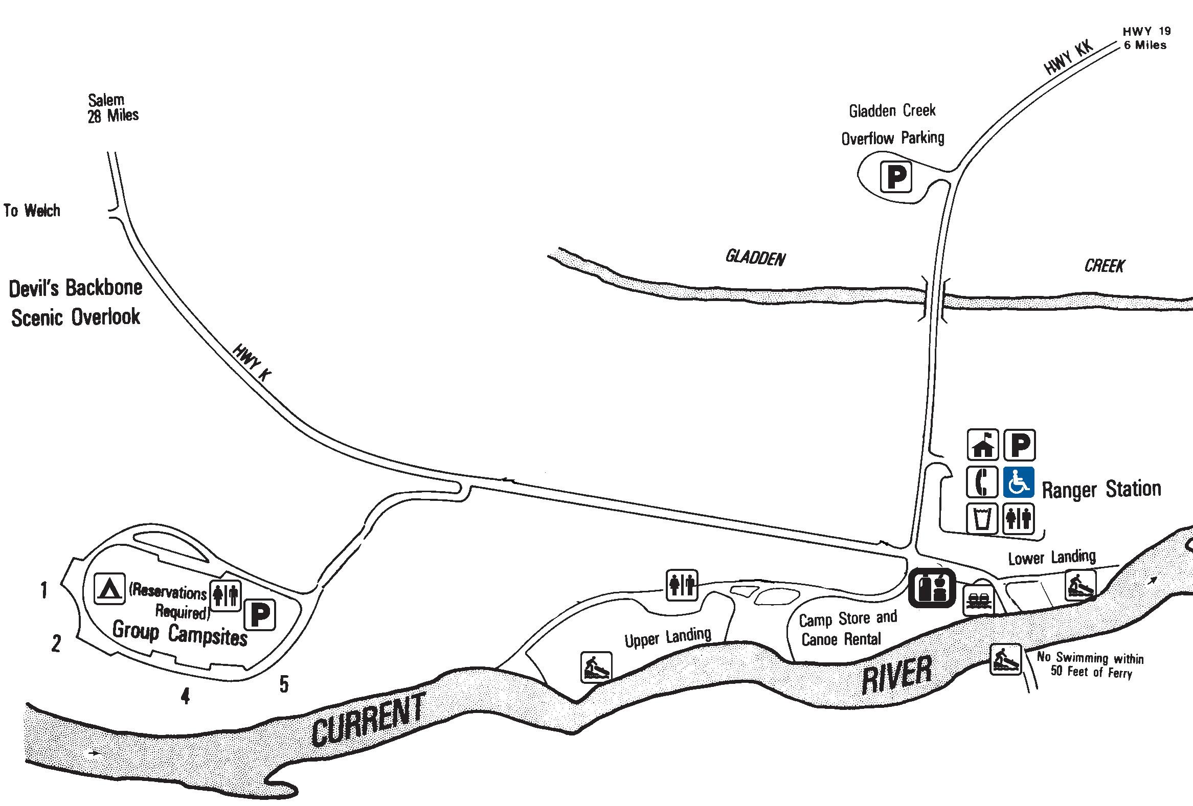
Akers has group camp sites only.
Akers Group Campground
Group campsites, located at Akers Ferry. The campground is located north of the junction of Highway KK and Highway K.
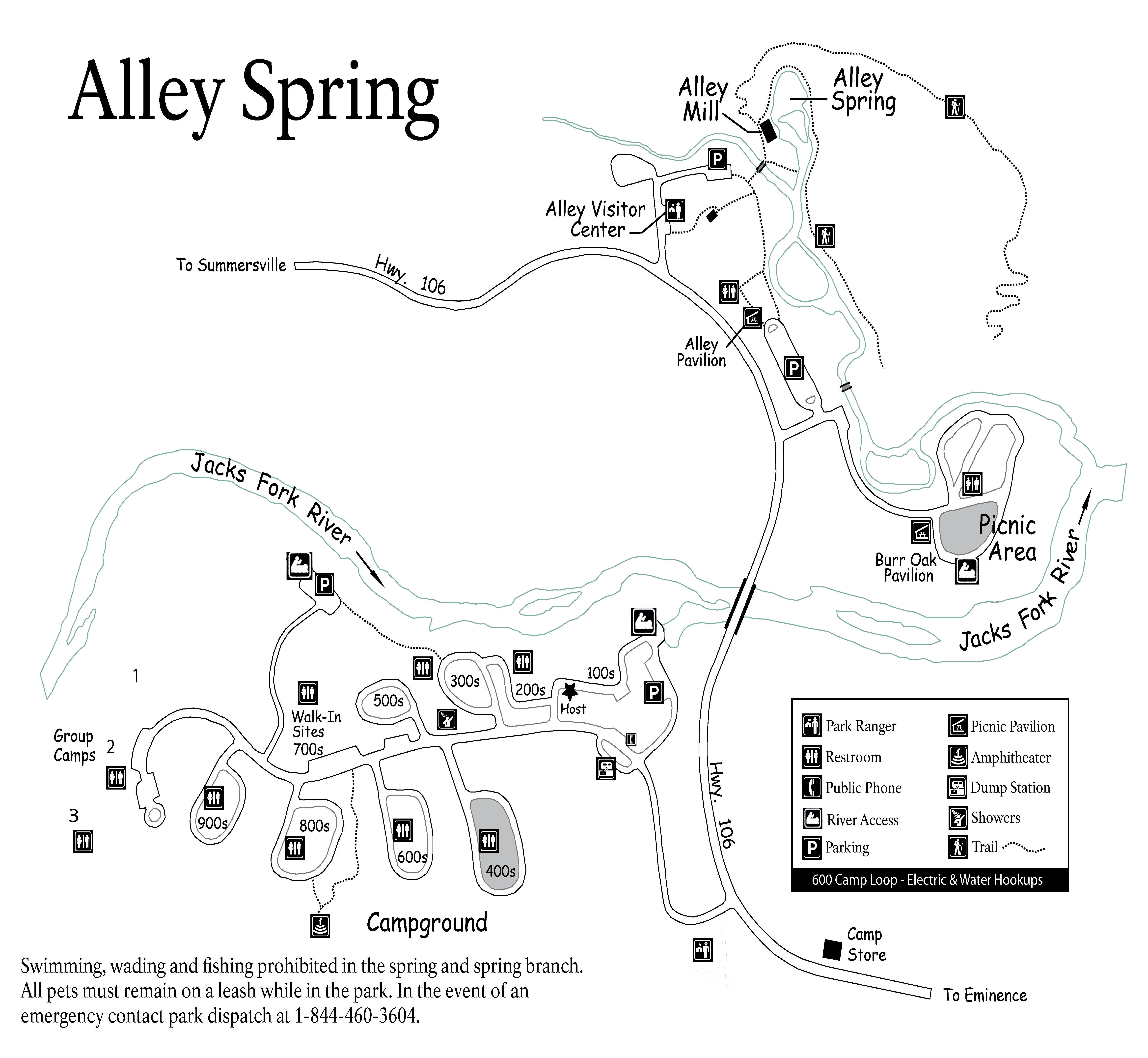
Alley Spring Campground Map
Alley Spring Campground
Campground located near Alley Spring, 6 miles west of Eminence, MO on State Highway 106.
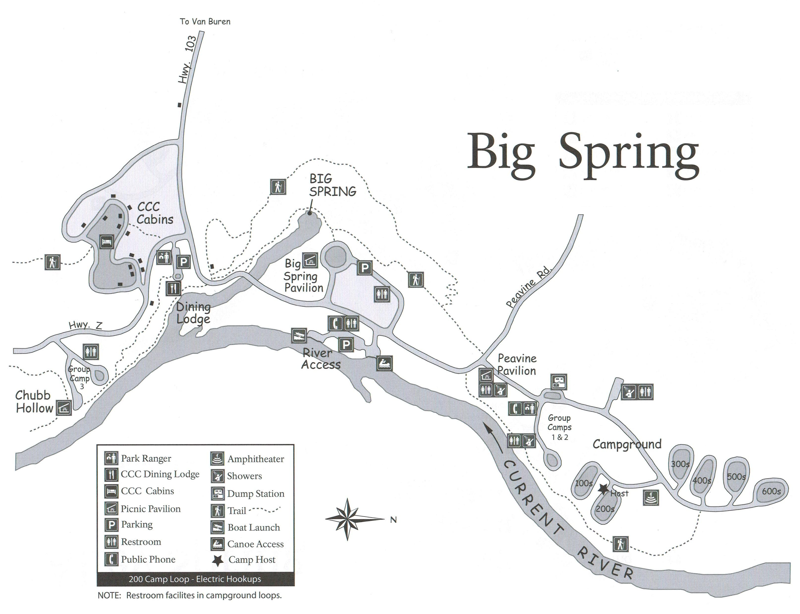
Big Spring Map
Big Spring Campground
Big Spring Campground is located just south of Van Buren, Missouri. The campground offers a variety of sunny or shaded
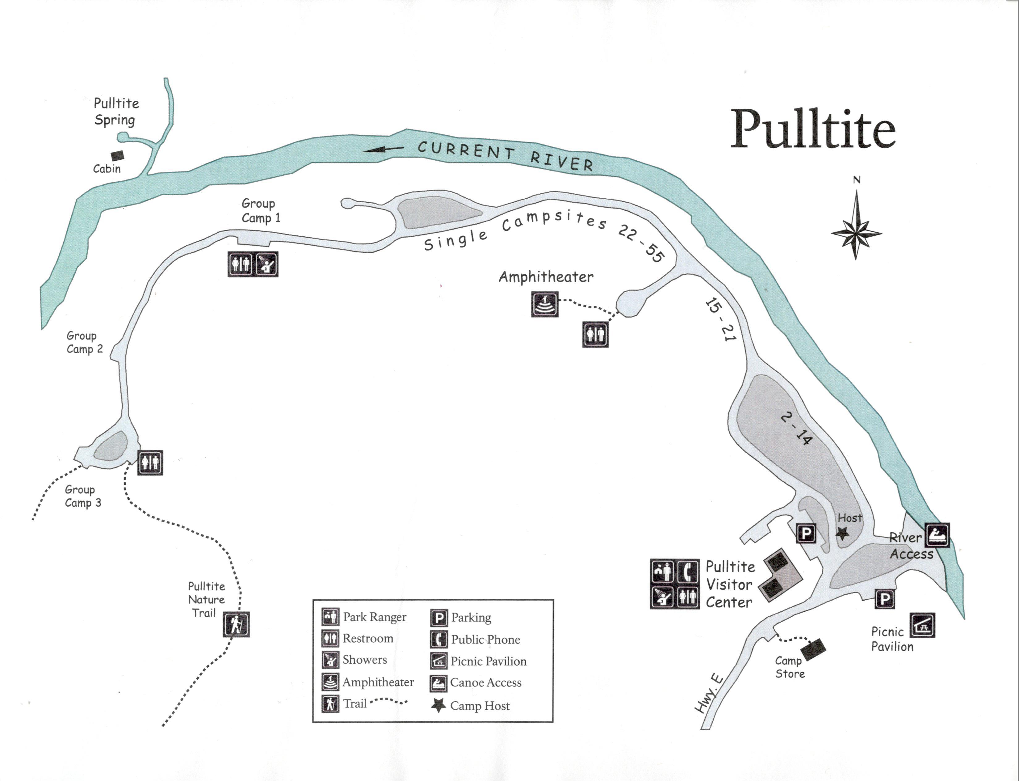
Pulltite Campground Map
Pulltite Campground
Pulltite Campground is located north of Round Spring, at the end of EE Highway off State Highway 19 in Shannon
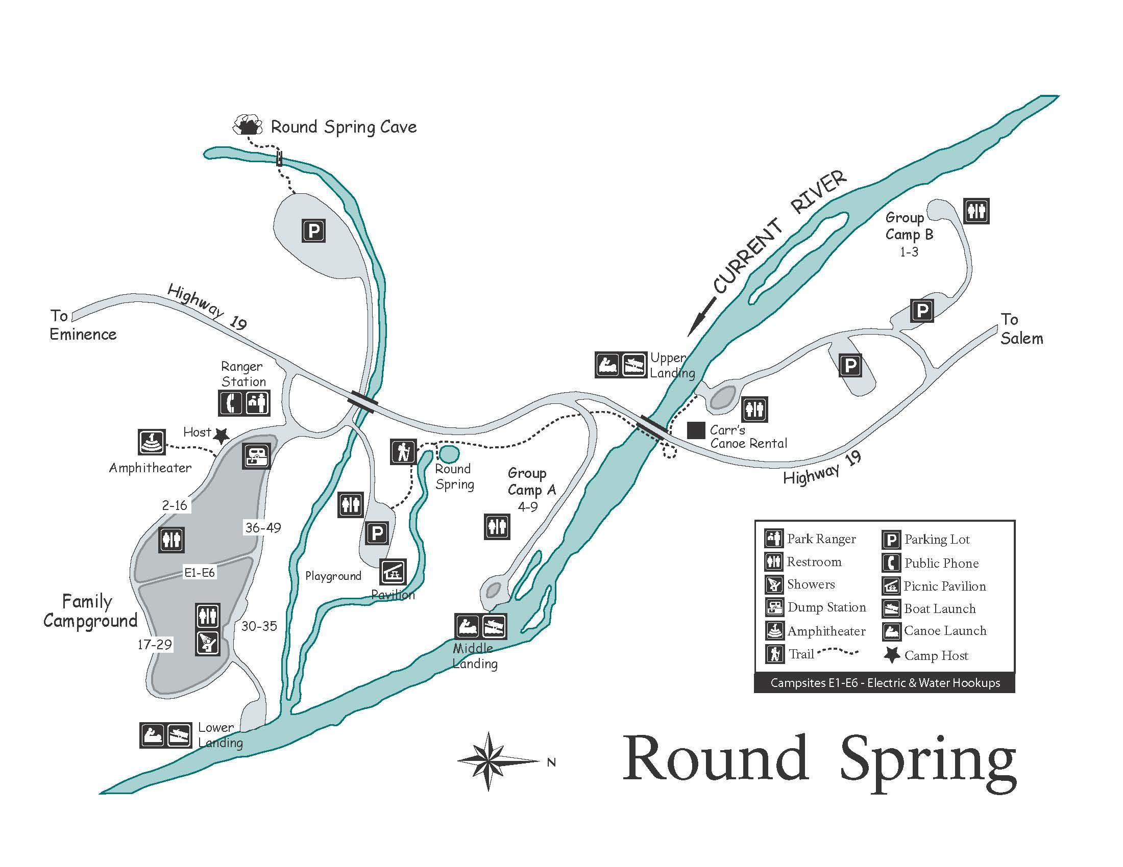
Round Spring Campground Map
Round Spring Campground
Round Spring Campground hosts sites in and along the forest, offering a more quiet, intimate experience with nature. This location
Two Rivers has one of the best views in the park.
Two Rivers Campground
Two Rivers Campground is located at the confluence of the Jacks Fork and Current Rivers, at the end of V