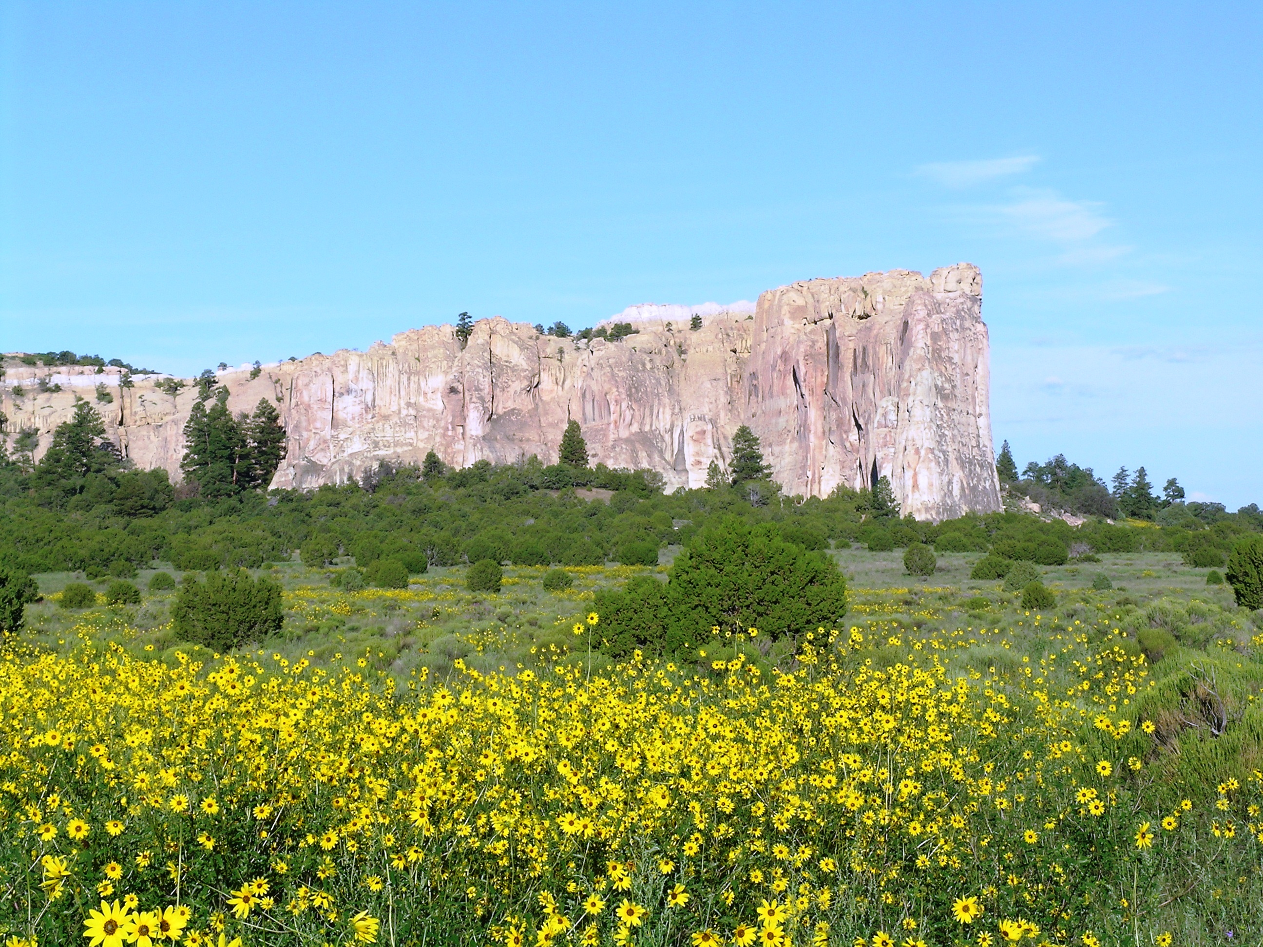
El Morro with Sunflowers
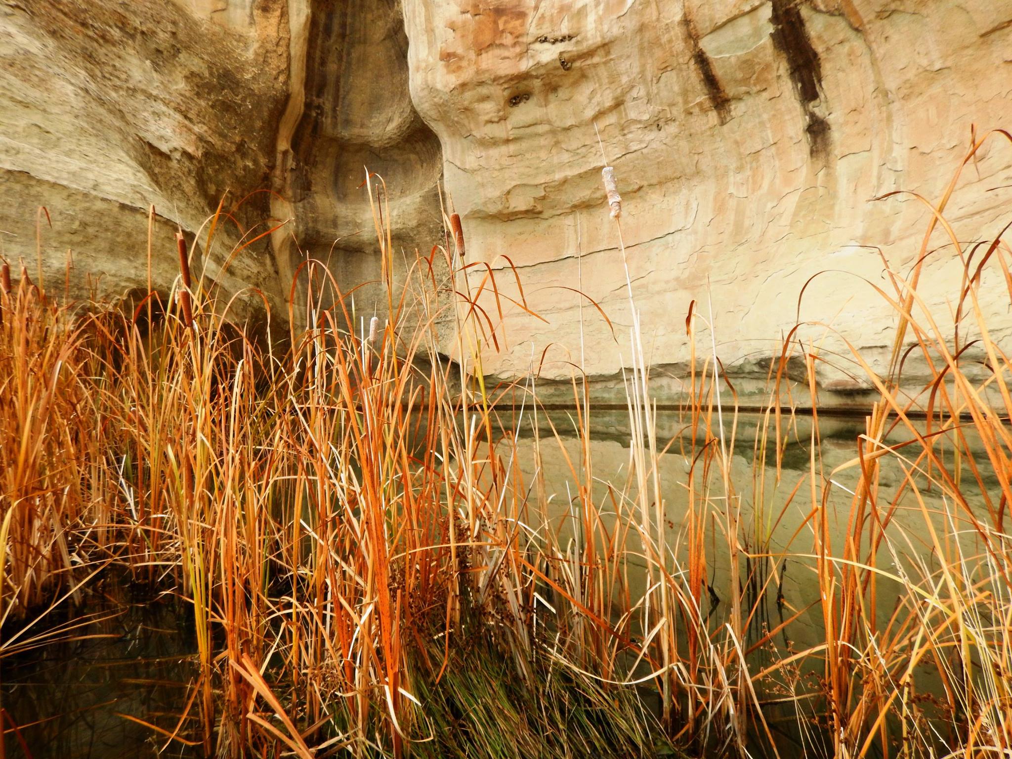
A drinking hole for visitors for hundreds of years, the pool at El Morro has significant cultural and historical value.
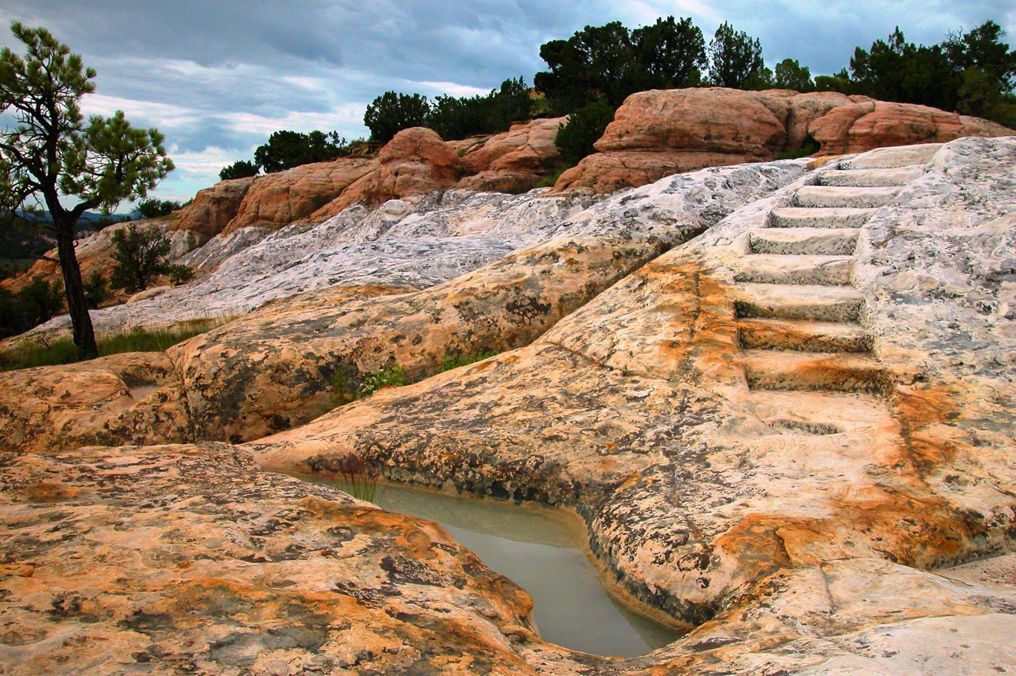
Constructed by the CCC, the historic headland trail at El Morro offers visitors great views and the archaeological site of Atsinna.
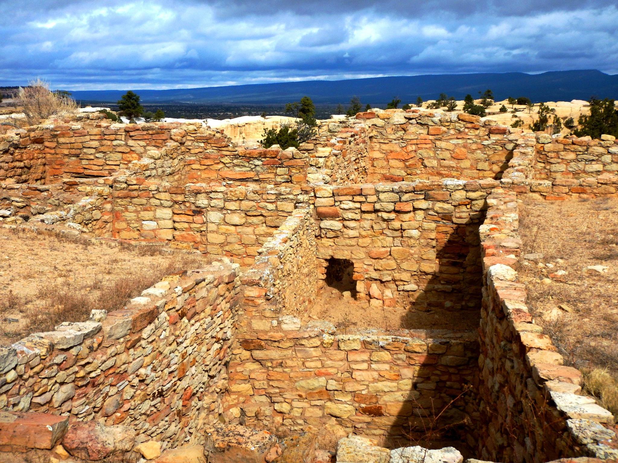
Atsinna Pueblo sits atop the headland at El Morro
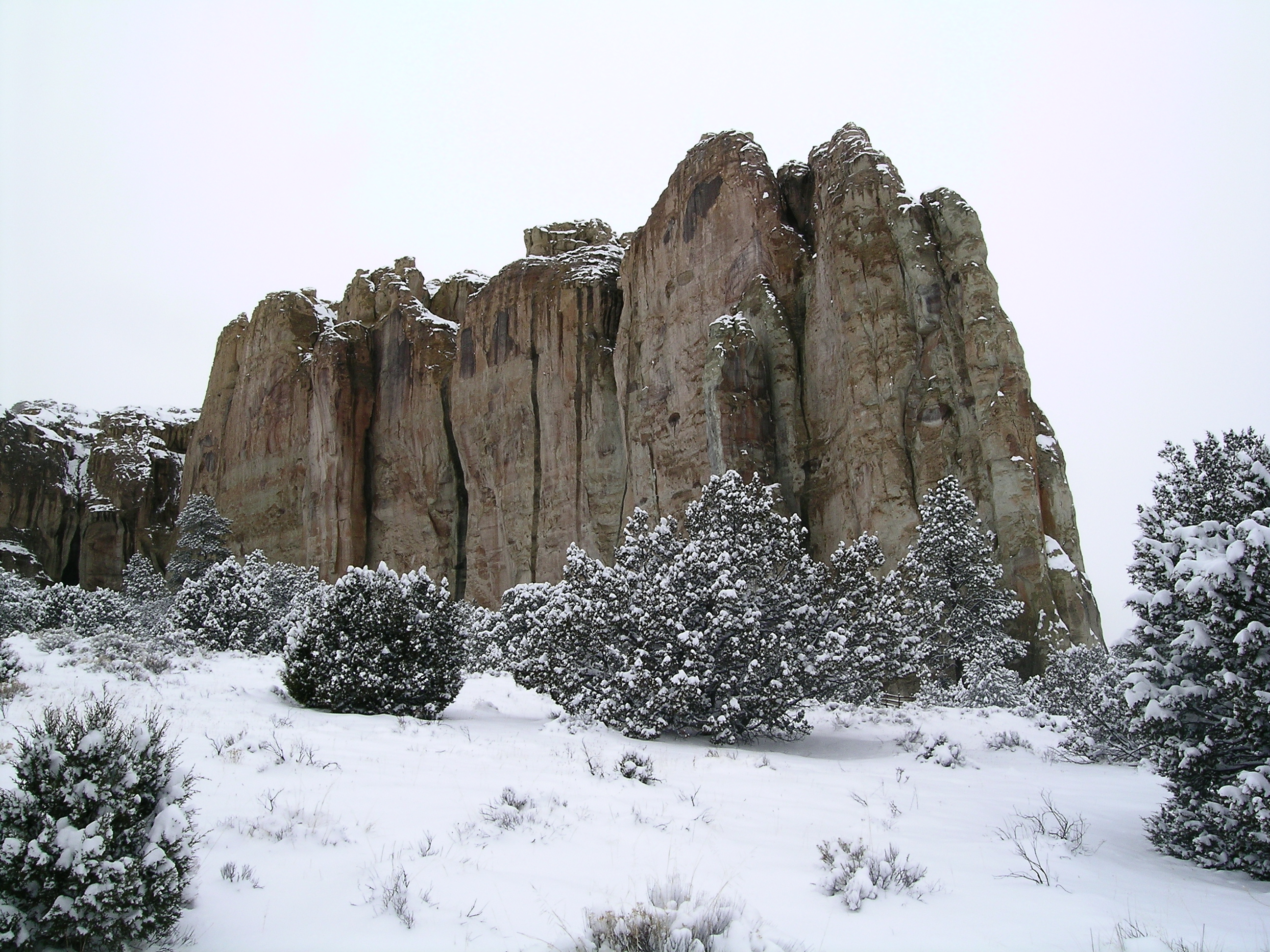
El Morro blanketed with snow
Physical Address:
Mile Marker 44.6 Hwy 53
Ramah, NM 87321
Mailing Address:
HC 61 Box 43
Ramah, NM 87321
contact-details
Phone Number: 5057834226 Voice
Phone Number: 5057834689 Fax
Email Address: wendy_gordge@nps.gov
Description:
Fees
Entrance Fees
Entrance Passes
Imagine the refreshment of finding water after days of dusty travel. A reliable waterhole hidden at the base of a sandstone bluff made El Morro (the headland) a popular campsite for hundreds of years. Here, ancestral Puebloans, Spanish, and American travelers carved over 2,000 signatures, dates, messages, and petroglyphs. Make El Morro National Monument a stopping point on your travels.
park designation:National Monument
Directions:
From Albuquerque, NM, or from the east: take Interstate 40 west to Grants. At exit 81, go south on Highway 53 for 42 miles to El Morro National Monument. From Flagstaff, AZ, or from the west: take Interstate 40 east to Gallup. At exit 20, go south on Highway 602 for about 31 miles. Turn east (left) onto Highway 53. El Morro is 25 more miles.
For detailed directions, please visit this link.
Directions
Operating Hours:
El Morro National Monument
Hours for the visitor center and park trails. The park is currently closed Tuesdays and Wednesdays. There is no access to park trails when the park is closed. Open all year, except Thanksgiving Day, December 25, and January 1. Trail access begins at 9:00 am and ends at 4:00 pm. Consistent with CDC guidance, the wearing of masks is currently optional in the El Morro Visitor Center.
Exceptions:
- 4th of July (July 4, 2024 - July 4, 2024)
- Closed Thanksgiving (November 28, 2024 - November 28, 2024)
- Closed Christmas (December 25, 2024 - December 25, 2024)
- Closed New Years Day (January 1, 2025 - January 1, 2025)
Weather Information:
At an elevation of 7,219 feet (2200 meters) winters can be cold and snowy. Summers are warm with afternoon thunder showers from mid-July through mid-September. Trails can close unexpectedly due to severe weather. Average snowfall: 40 inches per year. Average precipitation (snowmelt and rain): 16 inches per year. Warmest month: July, with average highs of 84 degrees and lows of 52 degrees. Coldest months: December and January, with average lows of 14-15 degrees, and average highs of 44-45 degrees.
Activities

Arts and Culture

Astronomy

Stargazing

Camping

Car or Front Country Camping

RV Camping

Food

Picnicking

Guided Tours

Self-Guided Tours - Walking

Hiking

Front-Country Hiking

Junior Ranger Program

Wildlife Watching

Birdwatching

Park Film

Museum Exhibits

Shopping

Bookstore and Park Store
Arts and Culture
Astronomy
Stargazing
Camping
Car or Front Country Camping
RV Camping
Food
Picnicking
Guided Tours
Self-Guided Tours - Walking
Hiking
Front-Country Hiking
Junior Ranger Program
Wildlife Watching
Birdwatching
Park Film
Museum Exhibits
Shopping